In India's wilds, whether traversing high Himalayan passes and the dense Western Ghats forests or remote central Indian landscapes--requires more than physical strength. Navigation is among the least-known but essential abilities required for trekking particularly when trails are hidden by fog, snow or thick forest cover.
On TrekUp India, trek leaders have seen time and again that hikers who are familiar with maps as well as compasses and GPS offline tools are more comfortable save energy, and are more responsive to unexpected events. Navigating knowledge eases anxiety, helps avoid dangerous detours and enhances the safety of Indian trails.
Why Navigation Skills Matter on Indian Treks
Numerous trekking routes in India:
- Lack consistent trail markings
- Through forests, in which paths split regularly
- Indistinguishable in fog, snow or heavy rain
Strong navigation skills help trekkers:
- Stay Oriented Be aware even when the path isn't clear
- Save time and energy: Avoid unnecessary detours and returning to the original route
- Respond to emergencies: Return safely to the campsite or to the roadheads if conditions worsen
- Stay Independent Rely upon your skills instead of relying on others' blind faith
Navigation isn't about speed. It is about safety and control.
Using Topographic Maps: Your Most Reliable Tool
The Topographic maps is the basis of a secure navigation.
What to Read on a Map
- Contour Lines: Close lines indicate steep slopes; wider spacing suggests gentle terrain
- Signs of the land Rivers, ridges valleys, saddles and passes aid in confirming your location
- Distance and Elevation: Estimate the daily effort, ascent, descent, and campsites
Practical TrekUp India Tip
Always keep always carry a printed map of the outdoors in a bag that is sealed. Note your routes and campsites ahead of time and keep track of your progress throughout your trek.
The Compass: A Silent but Critical Backup
The compass does not require charging and is able to work in any condition.
Basic Compass Use
- Make sure the needle is aligned to north magnetic pole
- The housing should be rotated to adjust your bearing
- Follow the direction of travel Arrow
Utilizing Compass and Maps
- Set the compass onto the map on your desired route
- Find the map's northern point and align it with the needle of the compass
- Verify your direction prior to you start
This technique is invaluable This method is extremely useful fog-filled meadows, snowy conditions, or in forests in which landmarks disappear.
Learn to use compass at home, or on short walks before using this in mountain terrain.
GPS & Smartphone Apps: Powerful but Conditional Tools
Smartphones are a great tool for support but only when they are used with care..
Offline Navigation Is Essential
Download maps prior to the hike using GPS apps that allow offline usage. Signals are not reliable or even absent in the majority of trekking regions.
Best Practices
- Download routes and maps in advance
- Make a note of your track so that you can trace your steps back when needed
- Mark water sources, campsites as well as exits and roadheads.
Battery Management
- Cold drains batteries quickly--store phones close to your body
- Utilize airplane mode when you aren't actively using the navigation
- Have a power source as a backup
GPS is supposed to be able to support rather than replace traditional navigation.
Practical Navigation Hacks for Indian Trekkers
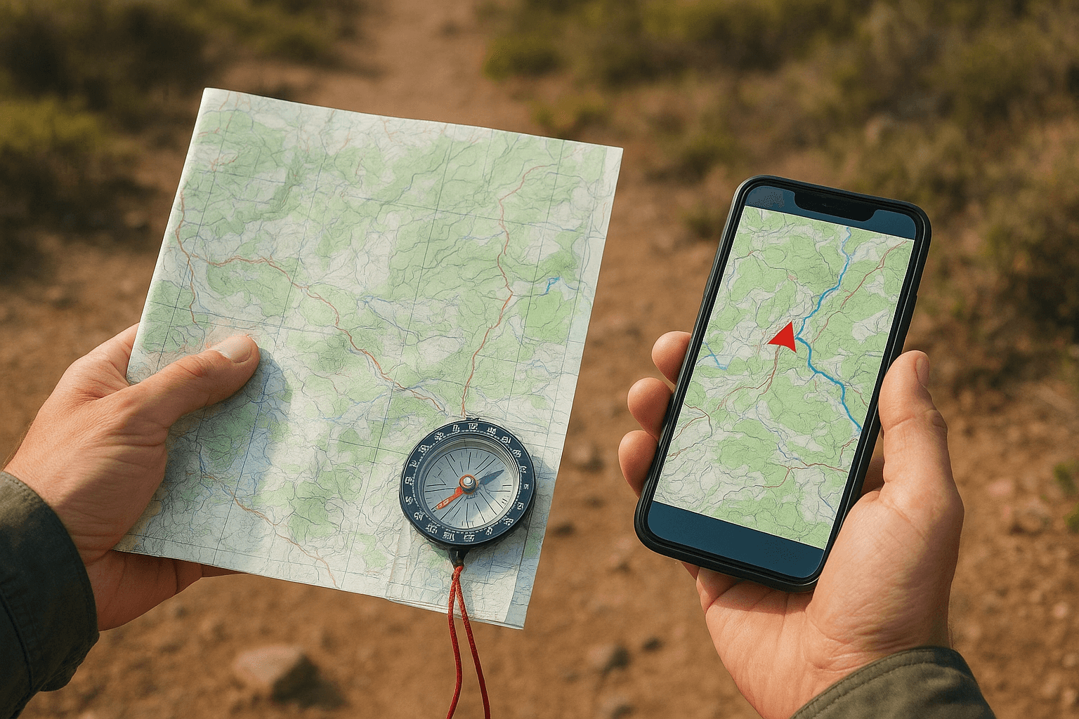
- Utilize the All Three tools together:The map to help plan, GPS for confirmation, Compass for security
- Always check your position:Do not just wait until you are lost
- Read Natural Indicators:Sun rises in east and sets in the west.The rivers flow downhill towards valleysRidges are often connected to with high points and passes
- Always Carry Redundancy:Batteries die, apps crash--skills do not
Reviewed by Dev Rawat - Trek Leader, TrekUp India
This article was examined by Dev Rawat, who has vast experience on the ground in leading treks through India's Himalayas, Western Ghats, and forested trails in India. The guidelines for navigation in this article can be verified through real-world conditions on trails that involve fog or snow cover as well as dense forest navigation as well as emergency corrections to routes that were encountered in TrekUp India operations.
Conclusion
The wilderness of India isn't just about technology alone. It is about preparation, awareness and a respect for the terrain. People who are able to navigate using maps, an compass, and use GPS applications offline can move more confidently and with lower risk.
We at TrekUp India, we have observed that mixing traditional navigation techniques with the latest technology lets trekkers travel more securely, avoid unnecessary stress, and to enjoy their travels more.
A reliable navigation system will not hurry you to your location. It can help you to understand the terrain and react calmly to any uncertainty and safely navigate the natural world.
Take your map with you. Be sure to trust your compass. Make sure to use your GPS in a responsible manner.And let the navigation guide you and not frighten you.
About the Author: Trekking Expertise You Can Trust

Operations Manager
Nanda Rawat holds a Master’s degree in Tourism & Hospitality and brings over 16 years of experience in adventure and leisure travel. He has led multiple Himalayan expeditions, contributed to ATOAI, and is trained in first aid by the Indian Mountaineering Foundation. A strong supporter of sustainable and ethical tourism, he plays a key role at Trekup India. Write to him at: nanda@trekupindia.com