Article Published On - 07-05-2025
Sara Umga Pass stands at an elevation of 4,800 meters and serves as one of the lesser-known yet formidable passageways in Himachal Pradesh, connecting Tosh in Parvati with Chota Dhara in Lahaul & Spiti Valleys. This challenging trek winds its way through breathtaking vistas and uncharted treks through the Parvati Valley’s towering peaks, including Papsura, Dharamsura, Indrasan, Deo Tibba, and White Snail – among others. Trekkers get to see an up-close view of the stunning Bara Shingri Glacier on their journey. This route winds its way across lush meadows, high-altitude grazing grounds, grasslands, rugged moraines, boulders, and scree, before concluding with an exhilarating glacier crossing that ultimately connects Parvati Valley to Spiti Valley – from verdant pastures to austere landscapes and back again! Sara Umga Pass Trek is designed exclusively for experienced adventurers seeking a challenge, offering a more strenuous yet off-the-beaten-path alternative to Hampta Pass with less foot traffic and the added advantage of lower costs. For maximum fun and enjoyment, plan to embark on this trek between July and October.
Day 1: Kasol to Tosh – Drive. Tosh to Buddhaban
Today, we embark on our adventure as we make our way from Kasol to Tosh while admiring breathtaking views of Parvati Valley. Once in Tosh village, we’ll start trekking along Tosh Nallah stream until reaching Buddhaban’s picturesque meadows, where we’ll set up camp for the night.
Day 2: Buddhaban to Sharam Thach
Today’s trek will lead you far beyond tree cover, passing through grassy fields and rhododendron bushes, before ascending over loose rocks to gain elevation and finally arrive at Sharam Thatch – an elevated meadow where overnight accommodation will take place in tents.
Day 3: Sharam Thach to Shamshi Thach
At Sharam Thatch, our journey begins with a challenging ascent through icy terrain along the Tosh River. Navigating our way through rocks and debris eventually brings us to the base of Tosh Glacier, where we will set up camp for the night at Shamshi Thatch. Kullu Makalu Peak forms an impressive backdrop for our tent stay for this unforgettable journey.
Day 4: Shamshi Thach to Kuta Thach
Our journey begins at Shamshi Thatch as we travel towards Kuta Thatch, an impressive meadow at the foot of Sara Umga Pass. Along our path will be loose rocks, glacial remnants and large stones on which will take us through mountain vistas as we make our way towards our campsite where we will spend the night sleeping in tents.
Day 5: Kuta Thach to Putiruni via Sara Umga Pass (4700 m)
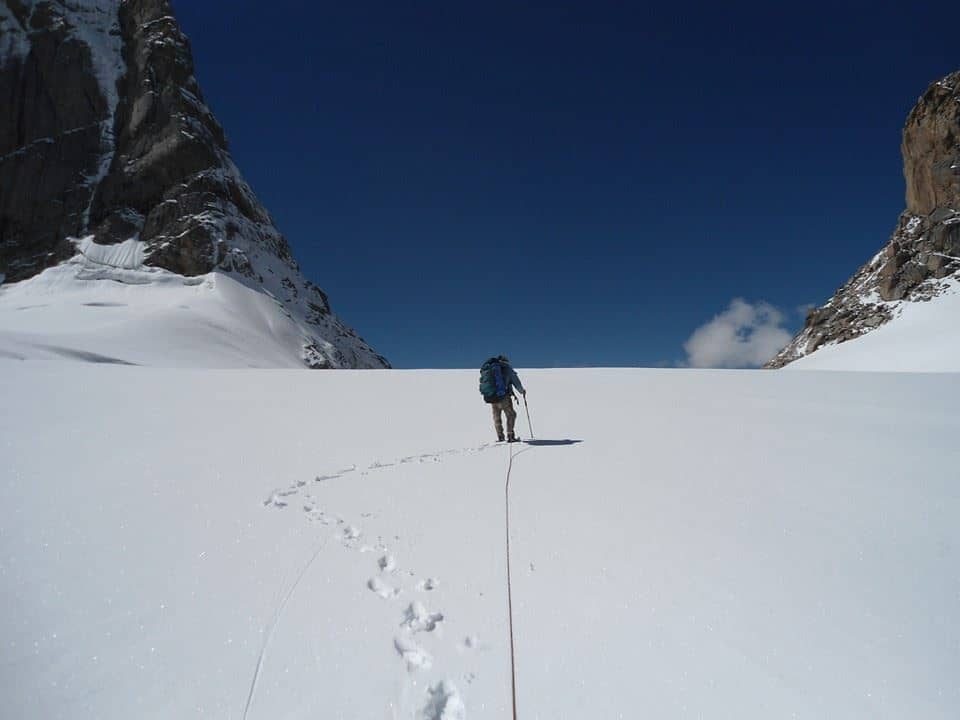
Start early to reach the Sara Umga Pass before midday. Our ascent from our camping spot can be steep, and snow or loose rocks make the journey challenging. At the pass, be rewarded with breathtaking vistas of Tosh and Lahaul Valley mountains; after which, descend down into Putiruni’s lush meadows where we camp overnight.
Day 6: Putiruni to Chota Dhara
Today is a long but manageable trek. The descent is gradual with occasional steep ascents and descents before we arrive at Chotadhara campsite on the Manali-Kaza highway for camping overnight.
Day 7: Chota Dhara to Manali Drive
As we reach the late afternoon, we shall say farewell and bid you good luck on our journeys.
By road: to Kasol or Barshaini via Bhuntar for easy access from Delhi as well as Chandigarh via night bus services. From Bhuntar to Bhuntar, take an auto or taxi towards Kasol before switching to either bus or cab travel towards Barshaini which serves as the trekking’s starting location.
By Air: Bhuntar Airport in Kullu is 35 kilometers away from Kasol. From the airport, buses and taxis are readily available to transport visitors directly to Kasol/Barshaini.
By Train, Chandigarh is the nearest major station. From Chandigarh, take the highway towards Bhuntar and Kasol and Barshaini.
Mid-June to mid-September is an optimal time for going on this trek.
June-July, the snowfields remain at higher elevations, adding another element of excitement.
September-August: Stable weather and less snow make for easier river crossings and better conditions overall.

Director & Founder
With over 12 years of experience in the Himalayas, he has summited multiple 6000–7000 meter peaks and led more than 200 expeditions across iconic routes like Bali Pass, Buran Ghati, Rupin Pass, Pin Bhabha, Stok Kangri, and Black Peak. His deep mountain experience and leadership make him a trusted name in Himalayan trekking. Write to him at: preetam@trekupindia.com