Article Published On - 14-02-2024
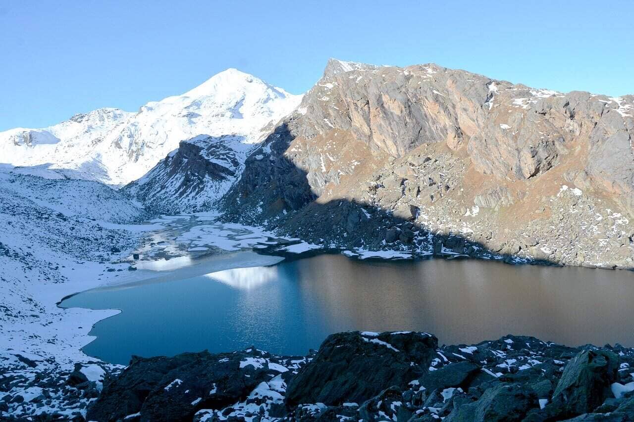
Starting our Mayali Pass trek in Uttarakhand from Reeh, nestled among vibrant rhododendron and pine trees. From there, we began a 12-kilometer trek towards Gangi village, which would mark our final village before Kharsoli campsite (15 kilometres away), followed by approximately 10-12 kilometres to Chowki, followed by another 6.5-kilometer trek into Masartal; all while following a gentle stream running alongside us on the left side. Gazing back, Khatling glacier comes into view. Masartal is an intimate campsite dotted with numerous boulders. To reach the Masar Lake summit, take the left path from Masartal Lake, but be prepared for an intense ascent with steep inclines up to 65 degrees; navigate rocky terrain to locate safe crossing points across the Mayali glacier; however, a two-kilometre climb makes this worthwhile.
Day 1: Dehradun to Guttu – 140 km Drive
Arrive at Dehradun early morning and take the vehicle ride to Guttu village, arriving there before evening time where you will stay overnight.
Day 2: Guttu to Reeh – 10 km trek
Starting your trek from Ghuttu, take the initial steps along a dirt track that may become extremely hot in the sun during morning hours. From there, follow your route through a forest leading you towards Reeh and its picturesque pine forest, where vibrant Rhododendron and bamboo trees await discovery along the path before ascending steeply through pine forests to finally camp out for the night under the stars in Reeh.
Day 3: Reeh to Gangi – 12 km trek
Today’s journey should begin from Reeh to reach Gangi, an offbeat village known for its cultural legacy. Most of today’s trek involves a gradual ascent, with only one challenging, steep section toward the end of your route.
Day 4: Gangi to Kharsoli – 15 km trek
At first, there will be a stretch where landslides often occur, so proceed with caution when crossing this area. After a brief ascent from Kalyani, you will arrive at Kharsoli – identifiable by its stream merging with the Bhilanganga river – by late afternoon and set up camp there.
Day 5: Kharsoli to Chowki – 12 km trek
Beginning from Kharsoli, this tour will lead us to the picturesque Chowki Campsite, an idyllic green meadow nestled under a snowcapped ridge and situated along the banks of Doodh Ganga River with views of Khatling glacier in the distance.
Day 6: Rest and Acclimatization
At 4000 meters, we are currently situated. Today has been designated as a rest day to help our bodies adjust to living at such high altitude, since the next days will include challenging climbs. There is the option for taking a restorative trek before returning back to base camp.
Day 7: Chowki to Masar Tal – 8 km trek
At first, we will climb a steep section overlooking Thalay Sagar and traverse a ridge with views of the valley below. Once closer to Masar Tal, our path becomes more distinct as we set up camp next to its picturesque lake.
Day 8: Masar Tal to Vasuki Tal (14435 ft) via Mayali Pass (16900 ft) – 12 km trek
Starting off the trek for today with an invigorating climb up rocky terrain along a steep ridge to reach Masar top is no easy task, but then it quickly drops back downhill before ascending a glacier and Mayali Pass summit. From Mayali Pass descent can be steep and may necessitate using rope and rappel down until reaching Vasuki Tal.
Day 9: Vasuki Tal to Kedarnath – 7 km trek
Kedarnath pilgrimage site lies 7 km away from Vasuki Tal and usually takes 3-4 hours to trek. Home of one of India’s 12 holy jyotirlingas devoted to Lord Shiva, once we arrive, we will pay our respects at the temple before retiring for an overnight stay at one of Kedarnath’s local hotels.
Day 10: Kedarnath to Gaurikund – 14 km trek
Following the marked 14-kilometer path to Gaurikund, we will spend the night in a guest house.
Day 11: Depart from Gaurikund
Pre-Monsoon (Mid-May to June): Snowfields remain, offering winter yacht adventures. Post-Monsoon (mid-September to early October): Bright skies and stable weather give way to beautiful landscapes.
By Air: When flying by air, Ghuttu is approximately 220 km away from Jolly Grant Airport, located in Dehradun (the closest airport).
By Train: For easy travel by rail, Rishikesh or Haridwar are the closest stations.
By road: Take a taxi or bus from Rishikesh to Ghuttu via Tehri Garhwal.
Operations Manager
Nanda Rawat holds a Master’s degree in Tourism & Hospitality and brings over 16 years of experience in adventure and leisure travel. He has led multiple Himalayan expeditions, contributed to ATOAI, and is trained in first aid by the Indian Mountaineering Foundation. A strong supporter of sustainable and ethical tourism, he plays a key role at Trekup India. Write to him at: nanda@trekupindia.com