Article Published On - 15-10-2025
| Region: | Karnataka |
| Duration: | 1 Day |
| Trek grade: | Easy |
| Maximum altitude: | 4,478 ft |
| Best Time for Treks: | Winter |
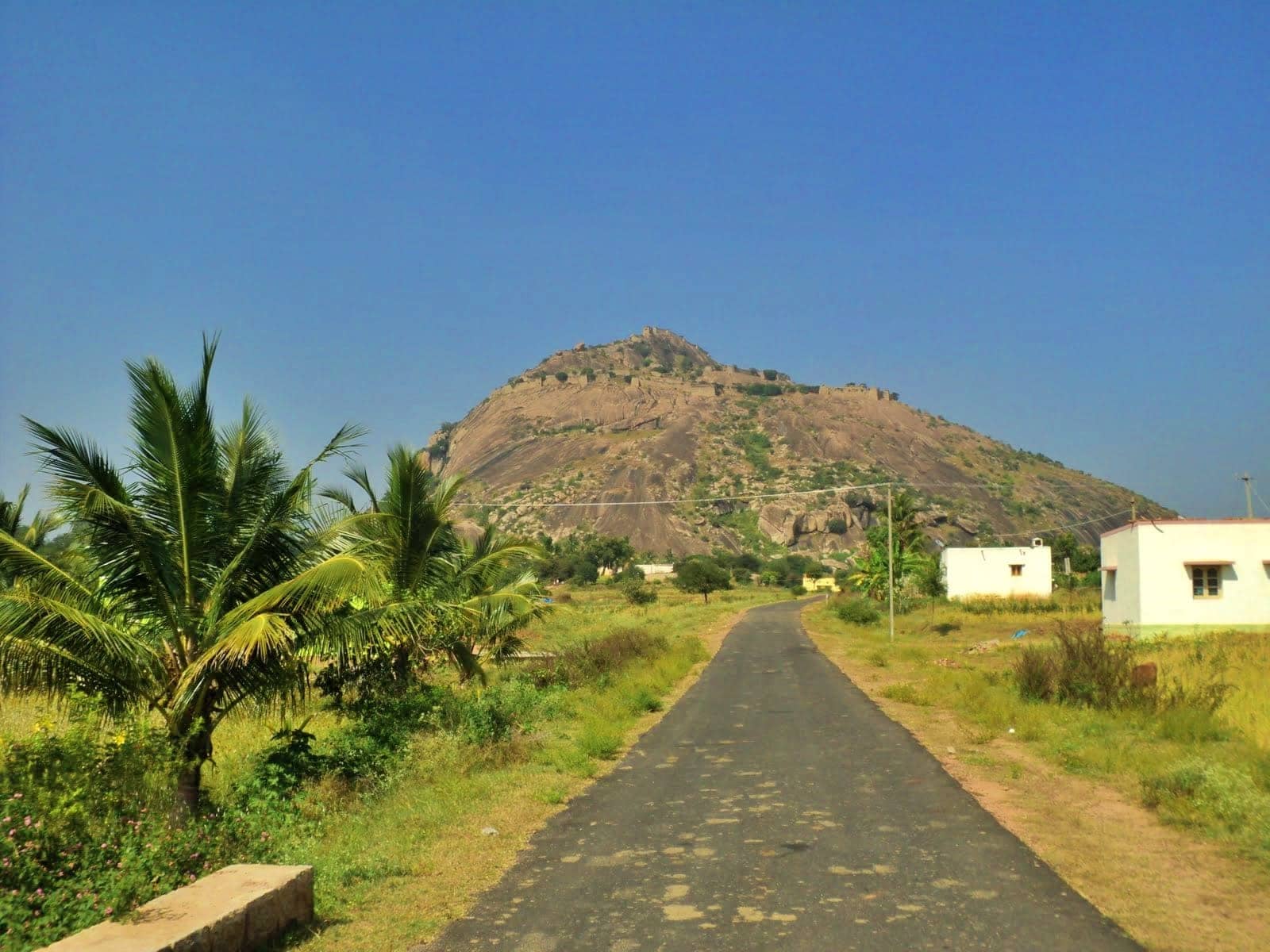
Channagiri located to the north-west part in the Nandi Hills chain, is one of the lesser-known trails in Chikkaballapura. Locally, it’s recognized as Channakeshava Betta. This is where the North Pinakini River and has an Omkareshwara Temple located at the highest point. There is something more in this mountain than the famous landmarks. It’s a wonderful day hike. The hike takes you through an array of interesting vegetation in two two hours. It begins in some tamarind and eucalyptus tree and then enters dense deciduous forest large boulder sections, and finally reaches a summit with amazing 360 degree views over the valleys, plains, and mountains surrounding.
This trek is best experienced in the evening.Morning heat rises quickly and makes the climb uncomfortable.
The trail’s entrance has some litter.Once you move further in, the trail becomes much cleaner and more scenic.
There are no shops or homes at the base and no water sources on the trail.Carry everything you need.
| Item | Quantity / Tip |
| Drinking Water | 2 litres per person |
| Snacks | Energy bars, fruits, dry snacks |
| First-Aid Kit | Basic essentials |
| Nearest Town | Sultanpet (3 km away) |
The trail passes through dry thorny vegetation.
There is designated parking available at the base point.You can drive up, park, and start the trek easily.
The trek is generally safe.Common sightings include:
This is one of those rare hikes that truly shines in the evening.In just 2 hours, you get:
A short trek with a big reward.
The beginning of the hike is clearly visible by an Ant hill, which is decorated in white and is worshipped by locals. The trail is just to the right of the structure, slowly climbing up.
It then enters wild bush that in winter is dry and filled with thorns. You can start this path. It’s well-marked, and follows a simple route with no turning in 15 mins. The Channagiri hill rises to the left side of this stretch.
The plateau begins to open ahead of you. Every now and then , make sure to turn to enjoy the views. Farmland dominates the landscape, but there are also a few urban structures scattered throughout the landscape.
The trail rises slowly. You don’t feel like you’re on the mountain in about 20 minutes. The path alternates between rock and steps.
About 25 minutes into this trail abruptly arrive in a wide, flat space. It is your first clear area. There are two of these clearings along the hike. This is the one that’s straight ahead. you’ll see construction sites as well as huge rock hills being ripped down. It’s not a beautiful scene, but it’s a landmark nevertheless. Alongside the construction zone on the right Skandagiri is an ideal triangular mound. Here, veer left. It’s almost a right-angled turning to your left. There’s no straight trail ahead. It’s a drop down to the lowest.
As your turn to the left Channagiri that was just to your left has now risen directly in front of your face.
The trail isn’t very well-defined in this area. It’s possible to get lost in the thick grass surrounding you. The gradient upwards is a little higher from here on out.
The next landmark you’ll see in 3 minutes is a massive rock to the left. If you’re a creative person, you could notice a grim face on the rock. The rock is on your left, go up.
The stone steps signify the path, so you’re not lost. In front of you, the view grows better and better.
Within 10-15 minutes the path leads you to massive boulders. They’re large enough to be climbed which brings to mind the huge stones of Hampi.
You can spend a few minutes on the boulders to take a refreshment. The perspective of Skandagiri is stunning from this spot.
From here you will be able to follow the trail for about ten minutes, crossing large rock. This is the second opportunity to clear. In monsoon, these rocks might be slippery.
In just five minutes, you’ll reach the grassy flat section. There’s a huge rock with a flat, smooth surface to the right. Just ahead of you and above you, you can see the forest’s deciduous stretch you’ll need to follow.
The trail may disappear into the forest here. However, if you search in the area for 5 minutes you’ll find an easy trail that you must take to the right that climbs into the forest. Be sure to follow the path on the right.
From this point the remainder of the hike is on a fully-fledged staircase. The trail is a mix of high grass and small canopy of trees. It is an unidirectional, well-maintained trail for approximately 30 minutes. There isn’t much to look ahead however, you can stop to look around behind you from time to time. The whole landscape opens up. On a clear day , you can see for at least 30 kilometers out to the sky.
As you climb the stairs The top of the hill opens before you. There’s a temple with the Karnataka flag atop it. In the distance, you’ll find a tiny structure that has an empty water tank in front of it. According to our sources, the tank is regularly filled however, the water is not suitable to drink. We don’t advise touching the water, either.
It is important to walk across the the mountain. It’s a vast , flat space that gives you an unobstructed panorama of the hills surrounding. It’s easy to spot the entire range that is Nandi Hills.
Begin your descent at 4.30 after 5:00 pm. It will take about an hour to get back to the base. The trek can be difficult at night Don’t go out after sunset.
Take the stairs until you get to the lowest point. The route is easy. If you are confused, stay to the left.
If you’re able you have, make sure to stop on the other clearing to rest for bit. The sky’s colors and the reflection of light on the landscape during the golden hour are spectacular, Don’t miss it.

Operations Manager
Nanda Rawat holds a Master’s degree in Tourism & Hospitality and brings over 16 years of experience in adventure and leisure travel. He has led multiple Himalayan expeditions, contributed to ATOAI, and is trained in first aid by the Indian Mountaineering Foundation. A strong supporter of sustainable and ethical tourism, he plays a key role at Trekup India. Write to him at: nanda@trekupindia.com