Article Published On - 05-11-2025
| Region: | West Bengal |
| Duration: | 2-3 Day |
| Trek grade: | Easy |
| Maximum altitude: | 867 metres (2,844 ft) |
| Best Time for Treks: | Round the year |
Buxa Fort Trek Walk across the border between India along the border of Bhutan and India.
Buxa is an area of forest close to the border between West Bengal and Bhutan. It is a plethora of hills, trees and rivers. Contrary to the name it is said to have more elephants than Tigers. If you’re looking for a unique experience the typical trails of the jungle it could be this one.
Given the numerous trails within forests, they could keep you entertained for a long time. However, the path from Buxa Fort as well as Pompsey Peak is tailor-made for weekend getaways.
Given the numerous trails within forests, they is possible to keep you entertained for hours. The trail that leads from Buxa Fort as well as Pompsey Peak is tailor-made for weekend getaways.
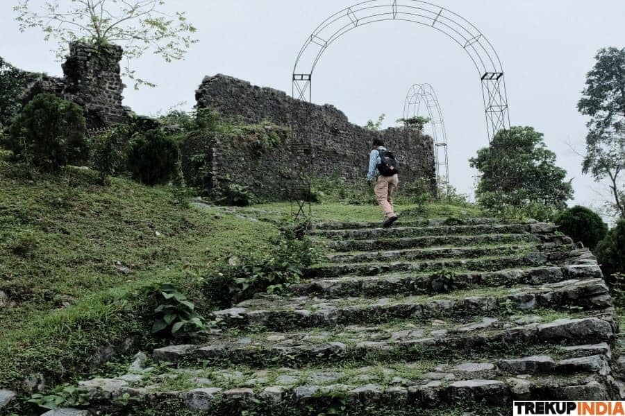
Buxa Fort Buxa Fort, situated at an altitude of 2600 feet was constructed as a cantonment for the East India Company in 1873. It was used as a deportation center to hold political prisoners. This was one of the largest and most well-known difficult to access prison in India following that of the Cellular Jail situated in Andaman.
Pompsey peak, situated at an altitude of around 4,000 feet is among the highest peaks of the region. Its peaks are visible across the forest in dense fog. The trail leading to the summit’s base is covered by tall fig trees. It takes about one hour to get from the base to the summit.
The fort is about 15km from Jayanti The lodge point. The trail is easy climb until the final 5 km, after which the trail gets steeper. To the right portion of this trail lies Bhutan. The famous Pompsey peak Pompsey appears stunning and inviting.
The trail passes over the forest floor and goes through patches of land that were cleared to provide food for elephants. This is to do not have to go through the surrounding villages. There are three dry river beds along the way, and you’ll likely hear the calls of peafowl while hiking.
After crossing the river’s third bed Santlabari is a tiny settlement, starts to take form at the shoreline. From Santlabari it’s an uphill 3 km climb up to the summit. When you reach the top, take a look back and trace the path you took; the mere thought of walking to the top can give you a boost of energy.
From here you will be able to see the ruin of the fort. It will take another half an hour to get to the fort. Its walls are deteriorating and are crumbling. There’s a small memorial for prisoners who have passed in the fort. here.It takes around 30 minutes to Lepcheka which is where you can stay the night.
In Lepchakha the area is home to an unassuming Chorten (shrine) which is located where you can have the magnificent panorama of three rivers three rivers – Dima, Bala and Jayanti all in the same frame. The way to the top of Pompsey peak is a walk through high fig trees with virtually no one around. Be sure to bring tents and food items as there is no place to purchase food or to stay. Lepcheka is the nearest location to buy your supplies.
It takes about an hour to reach the top it takes an hour to reach the top, which is beautiful when it is early morning as you are able to see the sunrise. You can stay the day on the top and then return to the base camp.
Note: It is possible that you may return towards Jayanti in the exact same time, if you’re running out of time.
The path down the hill to Jayanti is much more easy with gentle descents mixed with some steep slopes. The descent is steep up to Santalbari. The road is motorable. highway connecting Santalbari and Jayanti. You can use a vehicle to travel down that road, or opt to walk 5 kilometers.
Head Of Mountain Experts
-