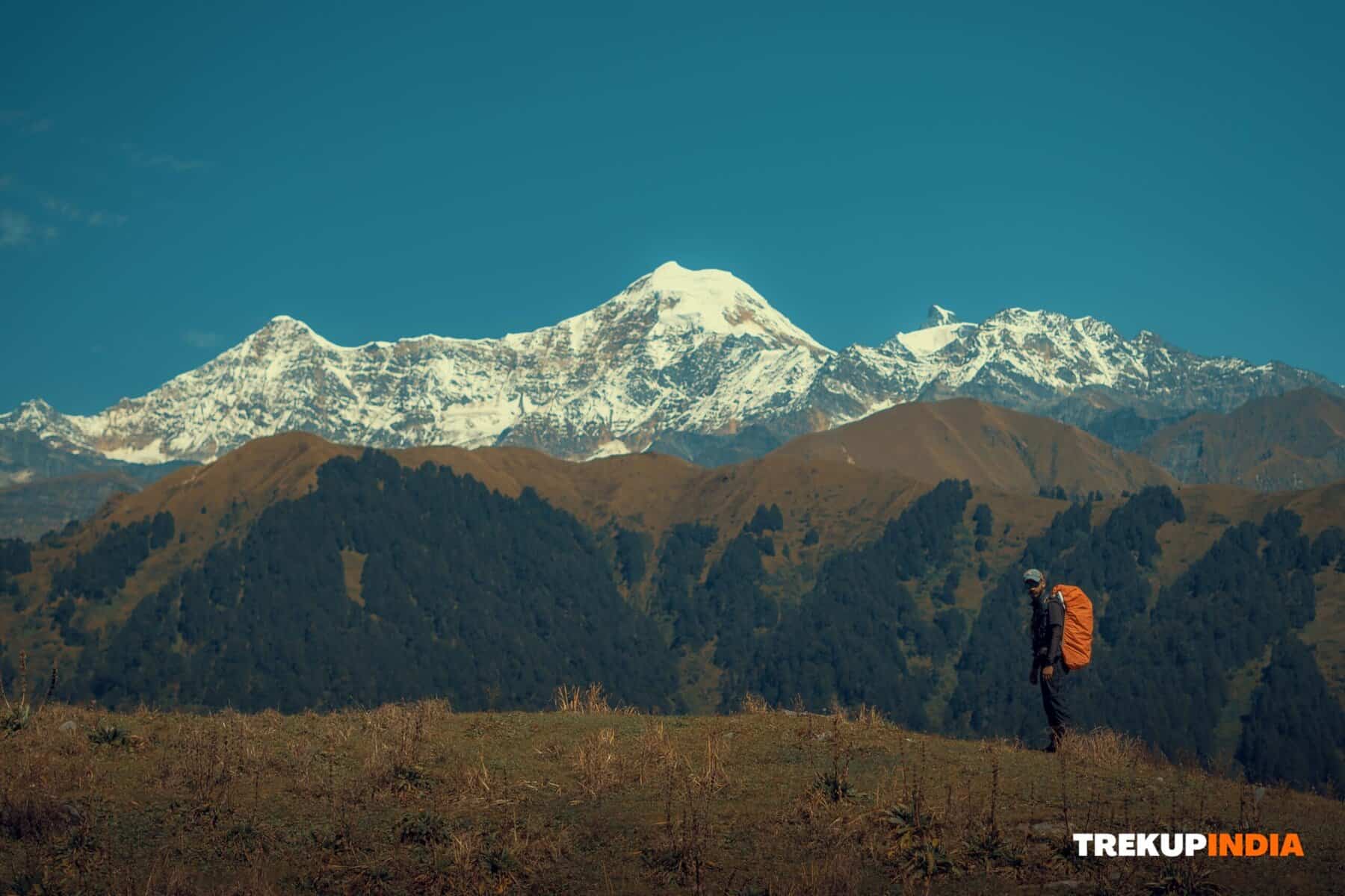
Nohra Jot Pass (commonly referred to as Chota Bhangal) is an obscure route located within the Dhauladhar range, which serves to connect communities within Chota Bhangal. Contrary to other passes in the area, this one is rarely visited, preserving its natural beauty while providing an ideal trekking trail. This pass connects Kothi Kohar village with Kothi Swar and Luhardi villages. Both sites can be reached via unpaved roads.
Local residents from Chota and Bada Bhangal have increasingly moved into the Bir-Billing area, which hosts much of their properties, vehicles and land. Due to frequent buses services running between Bar and Bir Billing these paths have become ineffective and must now remain closed off to them.
The snow-walking journey marked my inaugural experience walking on pure, uncontaminated snow. As soon as you veer off from the trail, it also requires traversing a river of muddy water that flowed along Uhl River for over an hour – this proved challenging but will teach you the value of torchlights on the trek as flash photography isn’t sufficient to illuminate every path you encountered.
Your trek will begin at Luhardi Village, where you will follow the Lama Dagh stream that begins near Nikora Pass in the Bada Bhangal Range. You will trek through an overpass to cross it and proceed toward Nahru/Nohra Pass. Chota Bhangal region consists of seven panchayats, with Poling Village being the largest. From there, you must go towards Cherna and Poling villages, which share borders yet are separated by the Lama Dagh stream.
Kothi Swar is home to Kothi Village, boasting an elementary school for local children as well as an accommodation hall that provides overnight stays for weary tourists. Meanwhile, Poling Village lies along a nearby river. As you continue down this trail, you become more immersed in nature as elevation gradually increases.
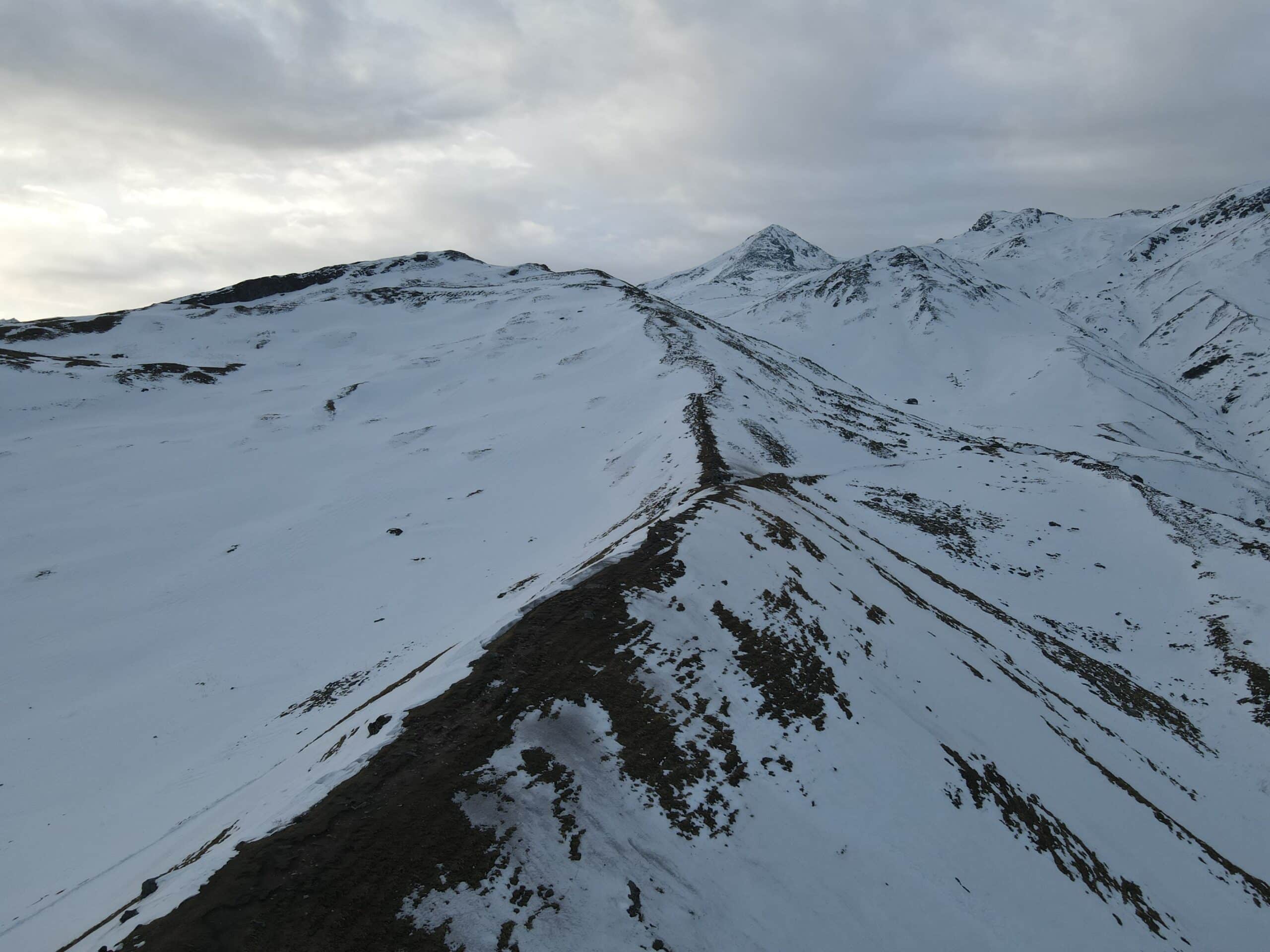
The trail snaked through dense rhododendron groves and Himalayan herbaceous vegetation, including temples constructed as emergency shelters by shepherds for temporary use during sudden and intense snowfalls. If you plan to embark on this adventure, prepare for a memorable journey through the rough Himalayan terrain. When midnight arrives, you have no choice but to continue since no towns or shelters are in the path. The remote trail can be difficult without a map and requires caution when you navigate, especially as you climb one hill after the other. At some point, you’ll have to make a turn and go down on the opposite side of the mountain and new challenges are waiting for you.
At higher elevations, expect difficulties due to the lack of defined paths, uneven terrain, and snow accumulation–especially if you’re crossing in early spring. We attempted to take this route during April of 2012 the deep glacier snow made the climb more difficult due to the lack of trails to follow. Its descent on the opposite slope can prove equally difficult and often requires the user to fall against the direction of your choice. Beyond this point, you’ll be confronted with huge glacial terrain that creates a long tiring trek.
As you progress the road, the rough terrain begins to change. You’ll travel through an arid area dotted with stones and grasses before reaching the shores of Uhl. Uhl. The river flows from 4,745m within Thamsar Pass and then is a part of the Beas Basin before returning to the source. The last destination of the trip, Barot, is a stunning spot where you can see the Beas as well as the Lama Dagh Rivers converge. The trek starts with Kothi Kohar, located on the Uhl River, but be aware that the last section is difficult and treacherous.
In Kothi Kohar, you can take two main ways to return to Barot:
- Continue on the main route to make an immediate return.
- Enjoy an exciting excursion through Billing Valley via Chinna Pass, an exciting route for those who want to experience thrills.
If you’re looking for a truly thrilling adventure take a look at Thamsar Pass from Kothi Kohar, passing through the Phalachak summer settlement before arriving at Bada Bhangal, an area of high altitude known for its spectacular landscape and difficult climbs. If you’re seeking an adventure that test your endurance and rewards with breathtaking scenery This could be your trek to do it!
Be well-prepared, trek safely, and take on the adventure that lies ahead in the magnificent Himalayas!